Renovation projects rarely fail because of poor design. They fail because the starting information was wrong.
Outdated documents. Unverified legacy drawings. Hidden structural modifications. Ceiling void complexities. Misaligned slabs. Steel was added over the decades.
In buildings of this scale, assumptions become liabilities.
As survey professionals, we operate on a strict principle: even a measurement without control is wrong.
For the architects leading this renovation, the requirement was clear: What is where, and how accurate is it?

Project Overview
Location: Kingsway Indoor Stadium, Level 1 / 130 Kingsway, Madeley WA 6065
Building Type: Indoor Sports Complex
Area: Approx. 5,000 sqm
Storeys: Two
Scope: Renovation & Spatial Usage Planning
Client: Contracted Architects
Engineering-Level Spatial Awareness
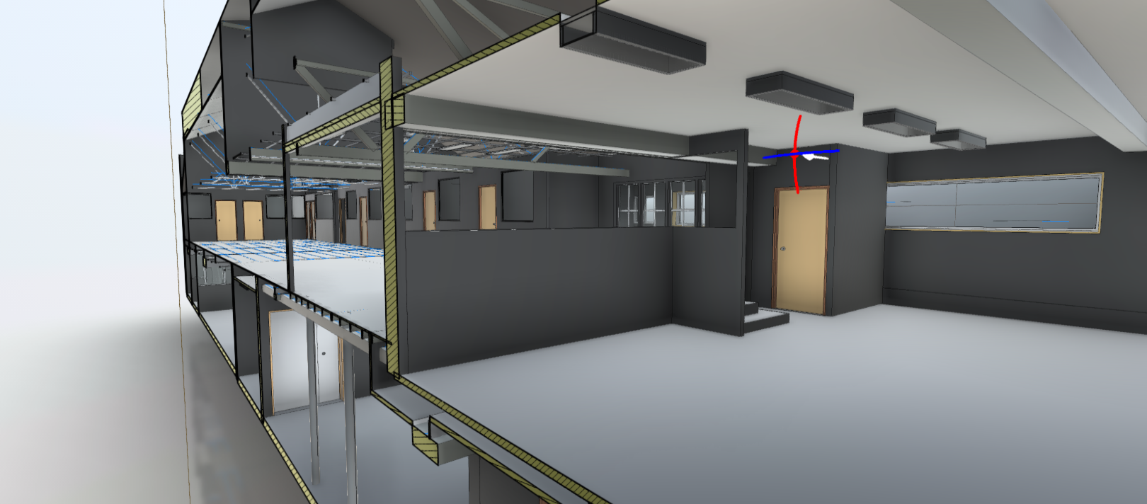
The design team required full internal and external visibility, structural alignment verification, slab level consistency, and dimensional reliability within engineering-level tolerance.
Without fresh reality capture, redesign risk increases, consultant coordination suffers, and rework costs escalate. Ground truth must precede design.
Multi-Layer Reality Capture Strategy
- Aerial Context Capture
A complementary drone layer provided holistic visibility and a broader perspective. particularly valuable for roof-level and contextual awareness relative to neighbouring facilities. Field time: less than one hour.
- Terrestrial Laser Scanning
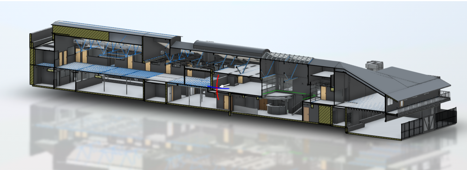
Nearly 200 scan positions were captured indoors and outdoors. Each scan required approximately one to two minutes, achieving survey-grade registration and engineering-level accuracy under five millimetres. Field operation completed in less than one day (outside working hours).

Geospatial Control
All data was anchored to MGA2020 (aligned to AUSCORS) and AHD (tied to local national level benchmarks). The dataset is geodetically grounded, not floating in digital space.
Why Point Clouds Alone Are Not Enough
Point clouds are powerful, but architects design in structured environments, not in millions of raw points. To support accurate interpretation and modelling, full 360-degree panoramic capture was recorded at scan locations, enabling a virtual walkthrough and improving spatial understanding

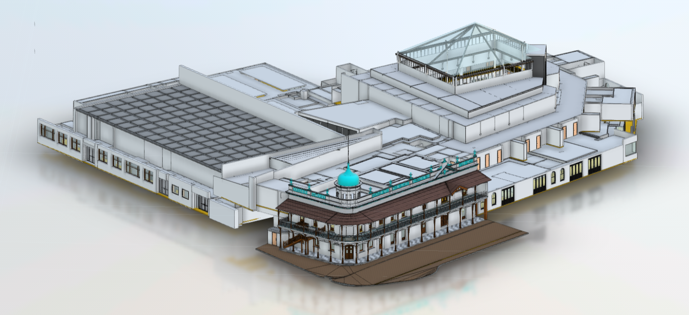
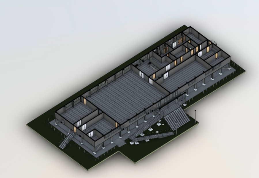
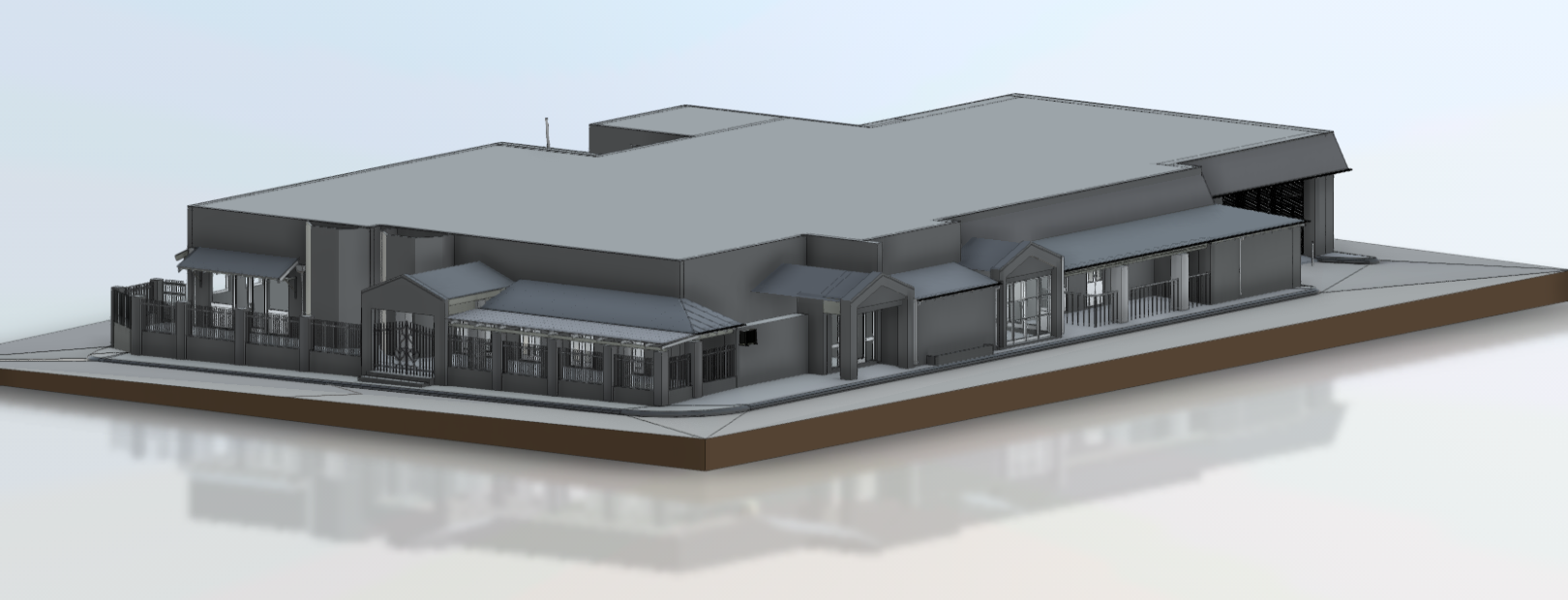
From Measured Reality to LOD 300 BIM
Registered point clouds were converted into a Revit model at LOD 300 (existing conditions), with architecturally structured building elements and seamless alignment for the next stage of design development.

Deliverables Included
3D outputs:
• Revit LOD 300 existing model
• Coordinated geometry aligned for downstream design
2D documentation:
• Site plan (1:300)
• Floor plans (1:400 with dimensioning)
• Reflected ceiling plans
• Legends, indexing, annotations
• Clear lineweights and symbol standards
The Scan Tech Surveys
Advantage
At Scan Tech Surveys, we specialise in delivering high-accuracy Scan to BIM solutions for internal building surveys. Using state-of-the-art laser scanners, we capture every detail and convert it into intelligent BIM models tailored to your project needs.
Whether you’re planning a refurbishment, managing a facility, or preserving a heritage asset, our Scan to BIM services provide a reliable foundation for smarter, faster, and more informed decision-making.