 Scan Tech Surveys
When It Comes to Solutions!
Mobile 3D Scanning Technology (Slam)
We are proud to announce that we have recently added Slam technology to our 3D Scanning equipment fleet. This gives us the ability to acquire large areas in a very quick time turnaround. Below is an example of a 250 m road section registered in PCG2020 and AHD datum. Based on captured point cloud a detailed survey can be accomplished.
We can also capture panorama imagery during the scan field capture. The imagery is essentially used for the colorization of the scan data and also for the interpretation of the data for feature extraction.
The scanner can be mounted on an extension pole which is perfect for ceiling void 3D Scans.
We apply right hardware and software for the right application. Our core vlaue is produce high qulity delievrbales.

2D Floor Plan
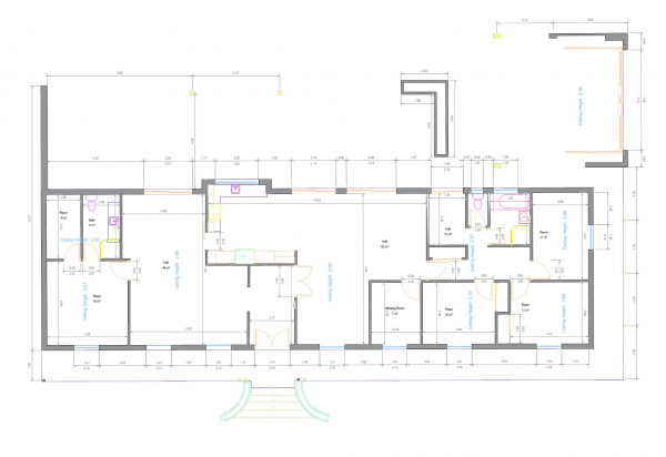
The most efficient and quickest way of creating floor plans from an existing building, especially old ones, is by utilizing 3D scanning technology. It gives you all the details in one go! No need to go back and add information like windows' height, ceiling heights, and lots of other details that could be missed in conventional methods.
Do not think of using any other methodologies than 3D Laser Scanning when you are revovating a house. Get the drawings done proprly as they are the base of any other work to be carried on.